
Team Presentation
Design Photos
Design Narrative
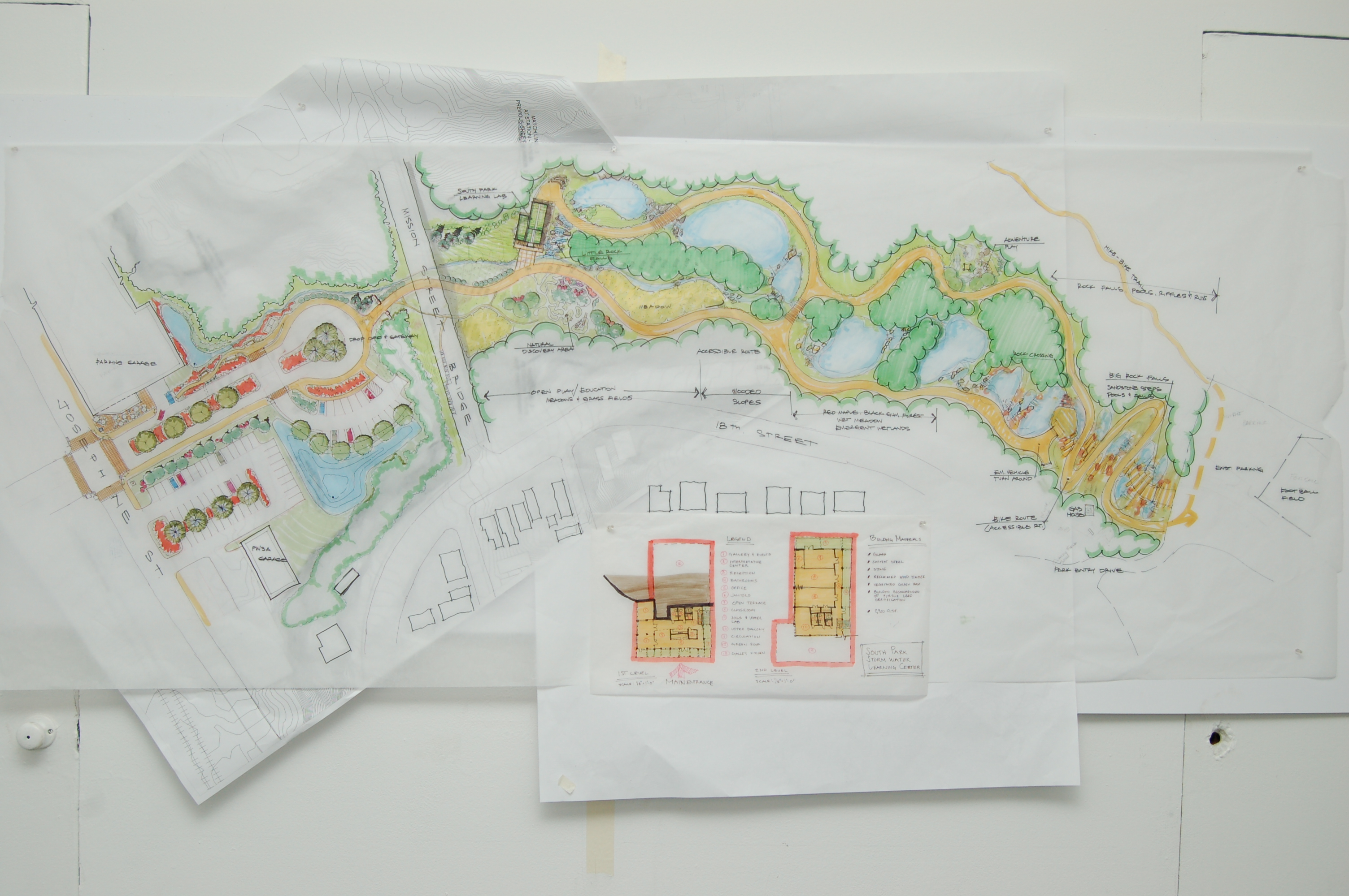
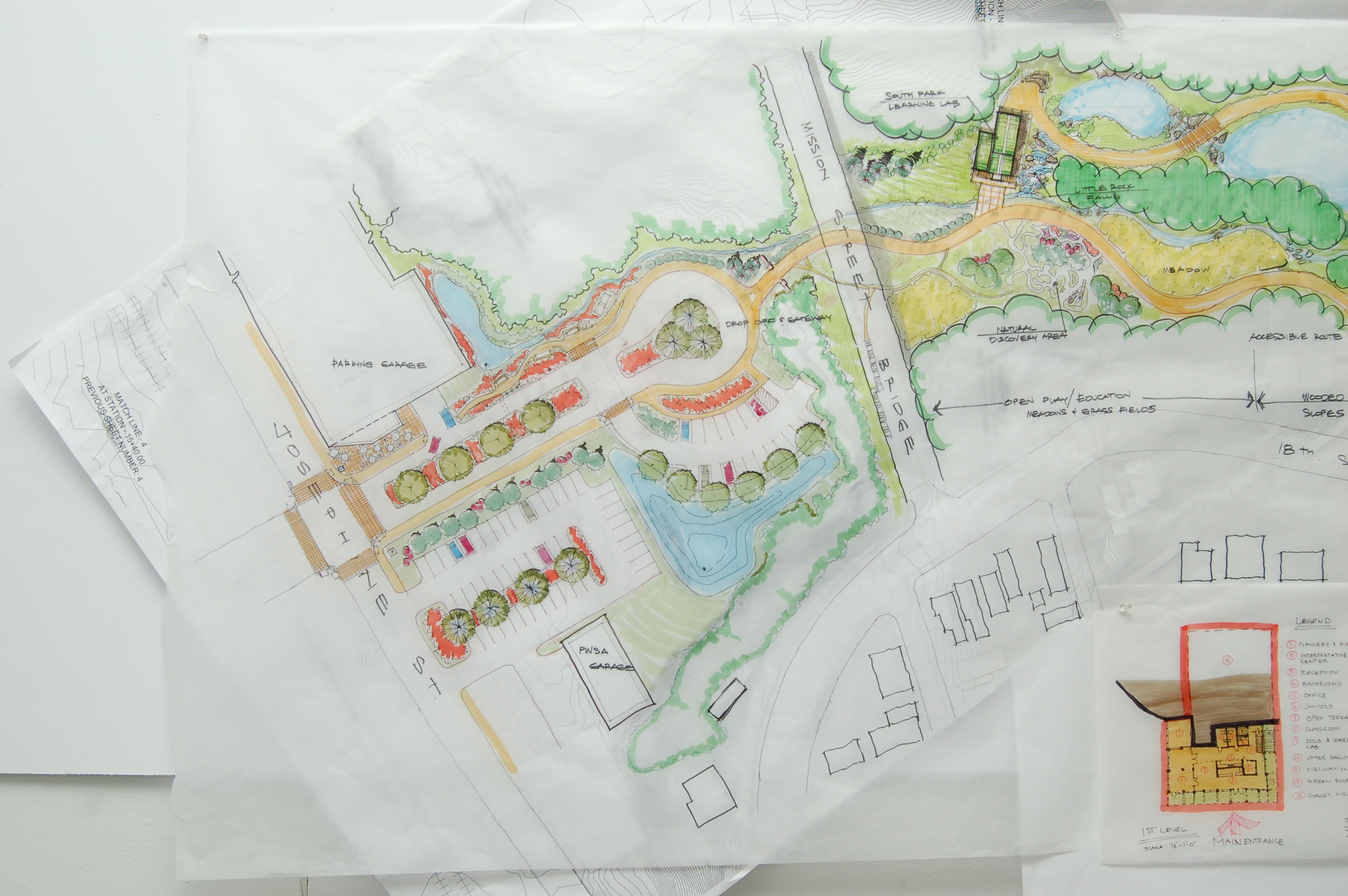
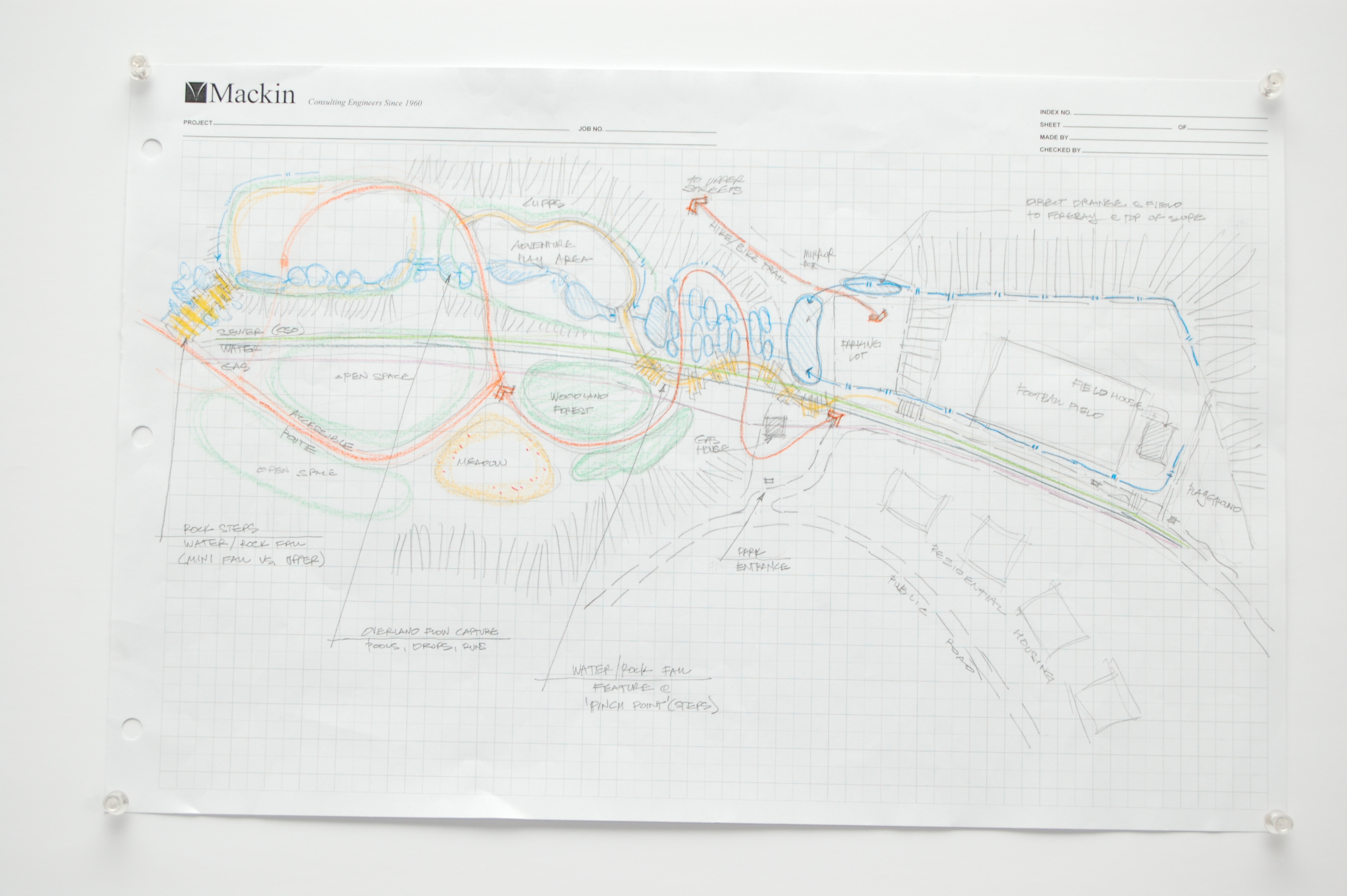
In the process of regenerating the landscape to collect and manage stormwater runoff prior to reaching the area’s combined sewers, Southside Park shall be transformed to present an attractive and intentional entrance at its northern connection with South 21st Street. Park features will create a functional and resilient natural stormwater system that will receive and treat four million gallons of runoff annually. These wetland systems will sustain a diversity of habitats that conscientiously complement the steep wooded hillsides and connect hydraulically with new right-of-way green features along South 21st Street and provide opportunities for environmental education, monitoring and reconnecting people with Pittsburgh’s rivers and streams.
Park Improvements
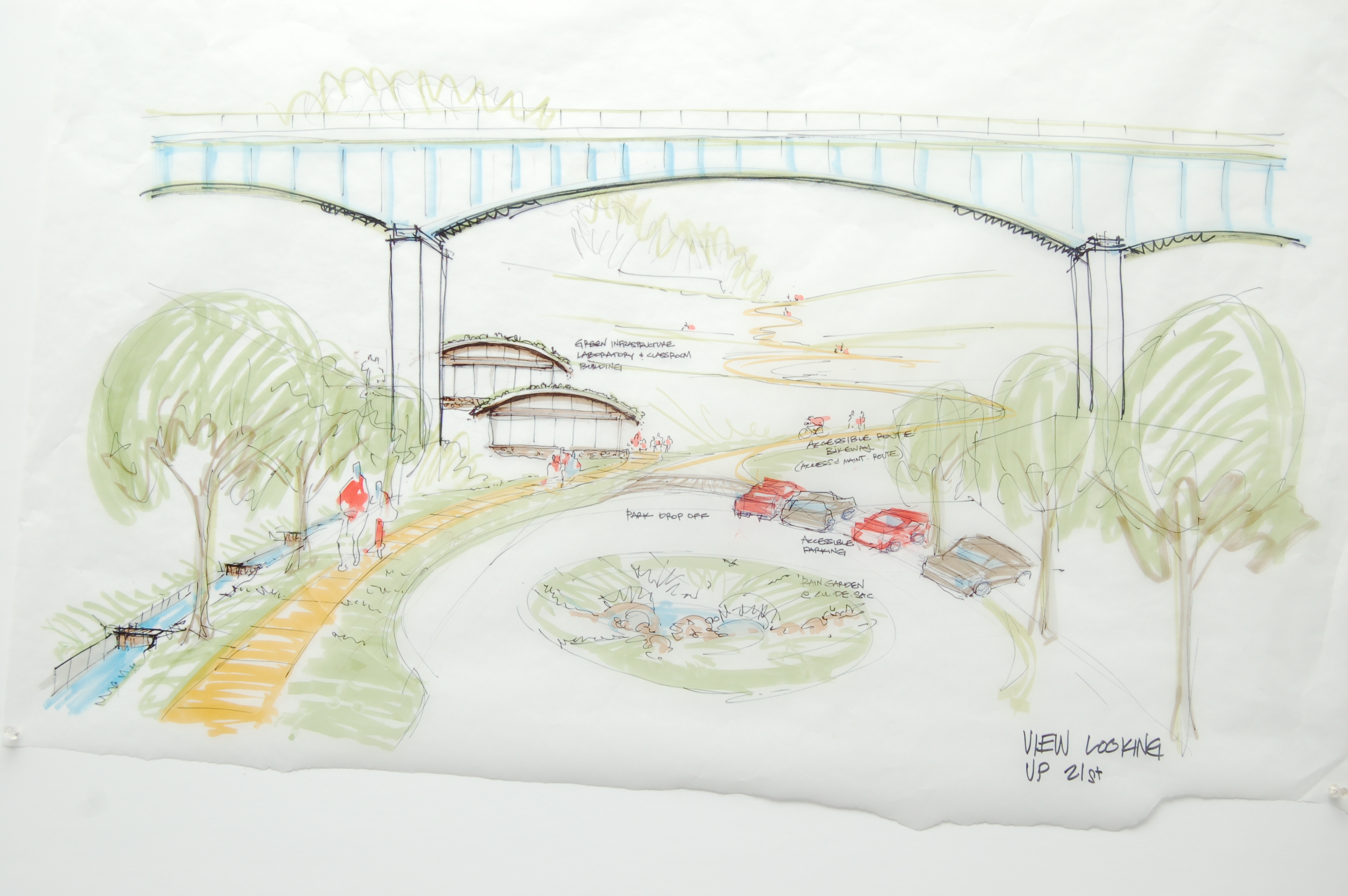
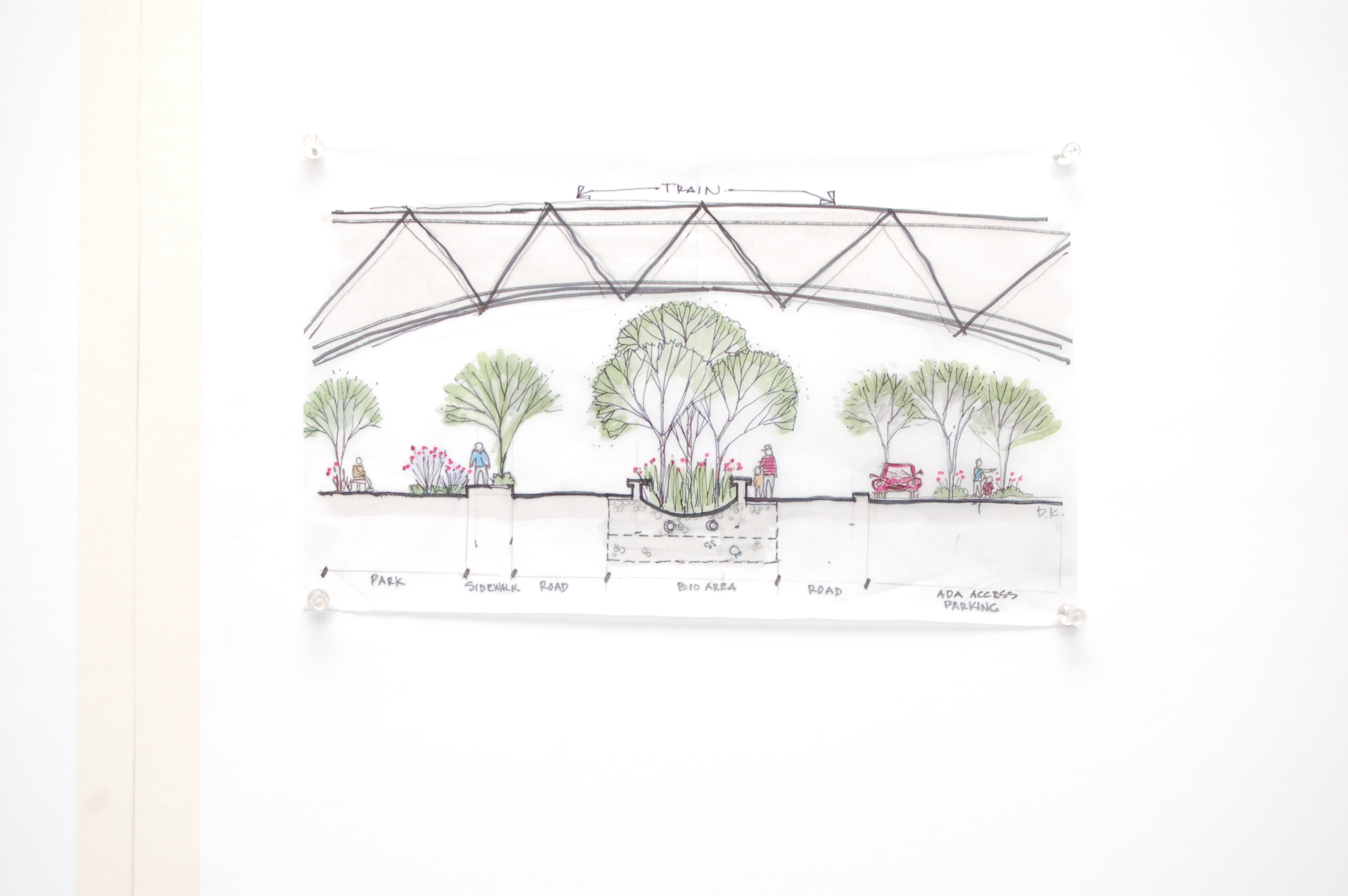
The northern park entrance shall be extended from the Mission Street Bridge to Josephine Street in order to create a stronger and more formal connection to the Southside flats. A proposed parking garage will alleviate some of the parking pressure found along South 21st Street while helping to activate the street by integrating a ground floor café and outdoor seating. Additional street parking will be moved off street into a surface lot in order to create room for a formal tree-lined boulevard leading into the park. The updates envisioned will be complete with a wide median bioswale, large pathways emphasizing pedestrian and bicycle use, and stone pillars that will reflect the stone features found elsewhere within the park as a call-back to historic WPA infrastructure projects. Located on URA owned land, this new parking lot will be entered from Josephine Street and also will also serve as a new PWSA maintenance garage.
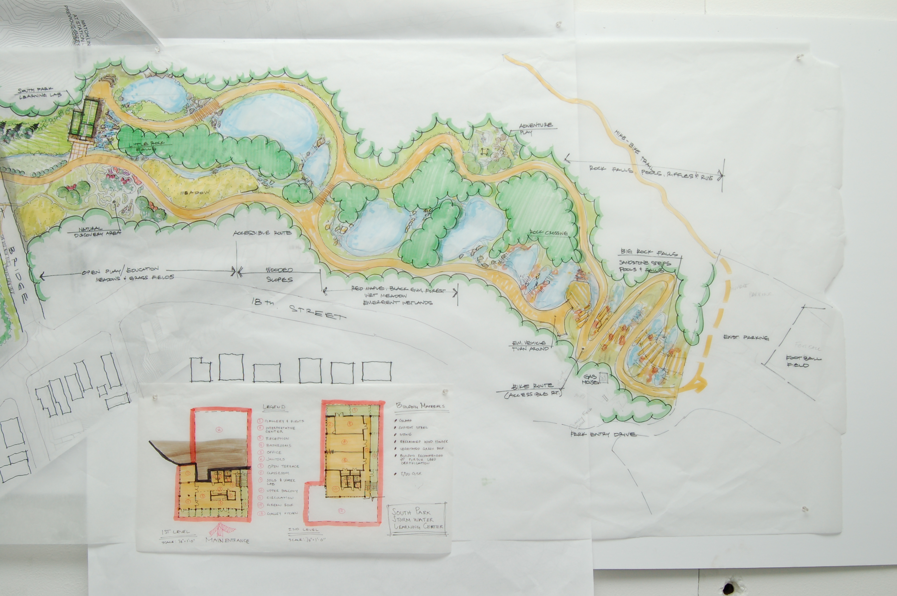
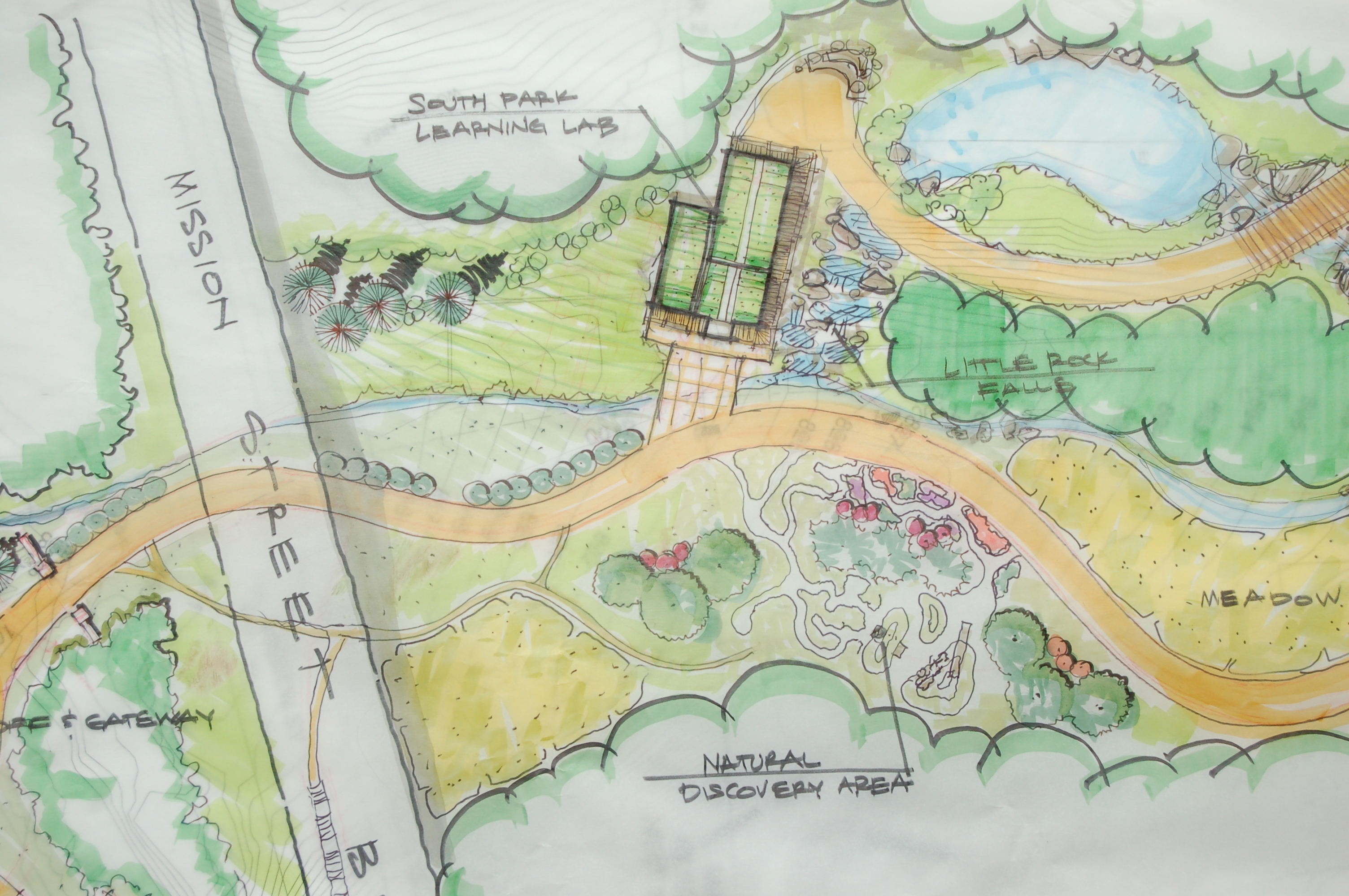
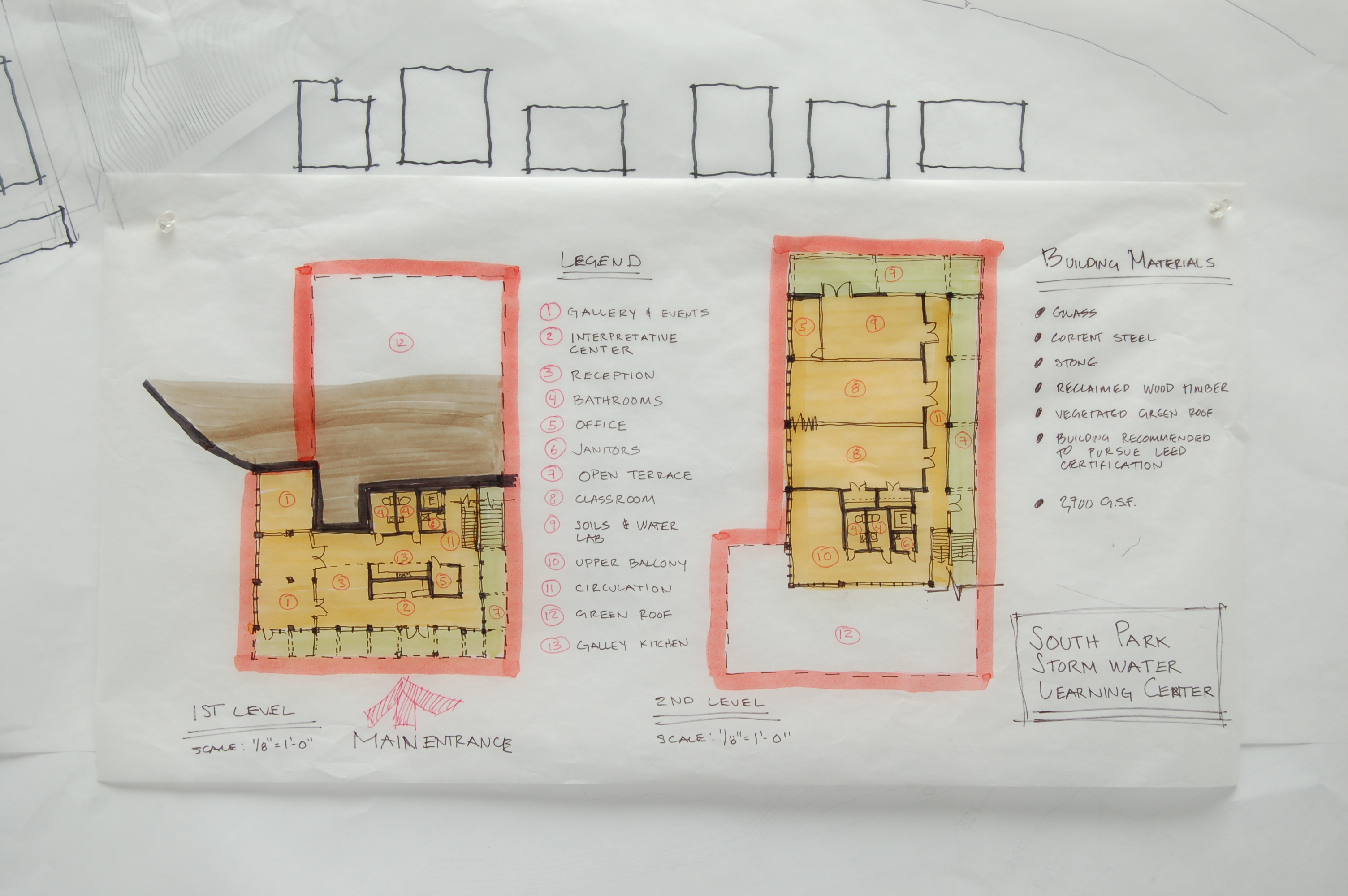
When entering the park from Josephine and South 21st Streets, visitors will approach an Environmental Lab and Learning Center which will provide a venue for studying and demonstrating local Southside stormwater issues, the consequences of combined sewer overflows (CSO), and local habitat functions. The laboratory will allow students to analyze water samples, study macro- and microbial communities in the water and soil, and assess the improved health of the watershed. The public structure will utilize local and regional materials as well as cutting-edge and demonstrative green technologies in an aesthetic manner that mimics the arches of the Mission Street Bridge above, and frames the street entrance to the park. In addition to laboratories, the building will offer programmable space for classrooms and display galleries, and rental for private indoor/outdoor events will generate supplemental income.
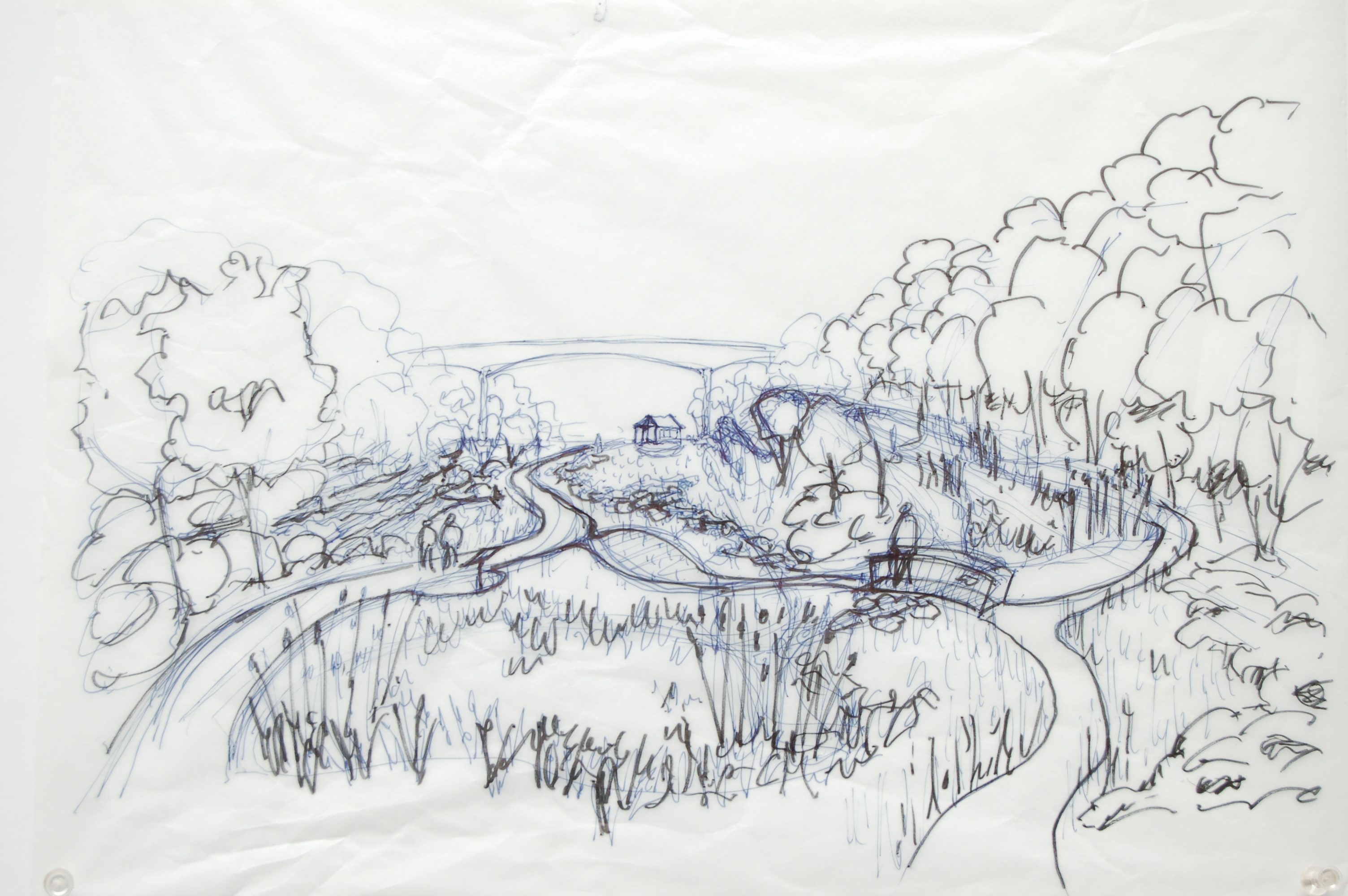
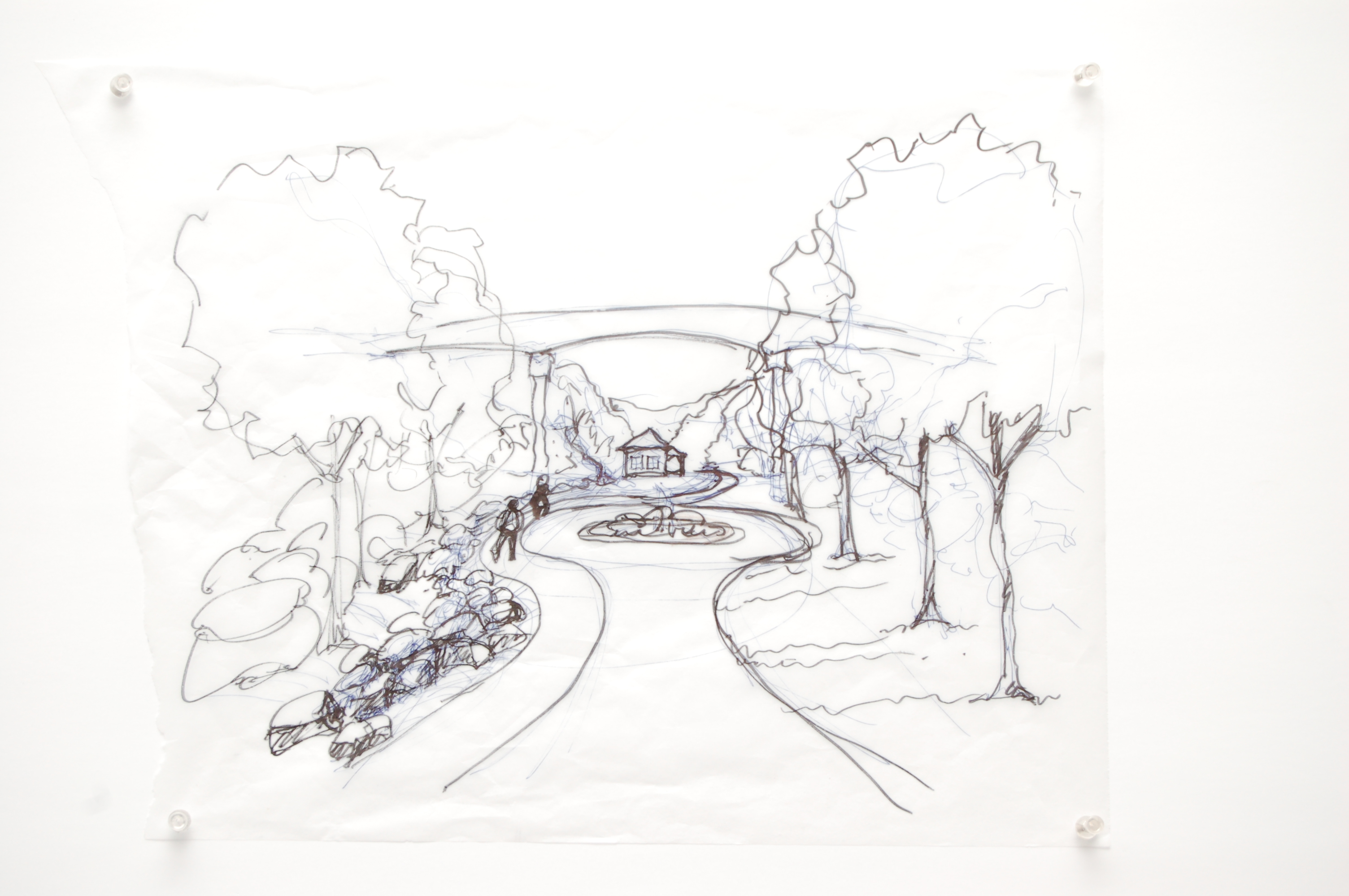
The main pathway through the park will convey visitors south through the lower section of the park and provide emergency and maintenance vehicle access to the interior. A narrower woodland trail on the east side will take visitors around and through wet meadows, constructed wetlands, forested wetlands, and programmed play spaces. A natural discovery area will complement the Learning Lab, providing opportunities to explore, create and imagine while learning in a natural setting. Native seed pod treasure hunts, boulders with fossils, grassy mounds to roll down, forts made out of logs and sticks, snags to climb over, and a maze trampled in a patch of grasses will further connect children to nature. In addition to the natural discovery area, You need play area design services that can provide you with the opportunity to learn through play. An adventure playground like the others (view here to see) will draw older kids and teens to challenge themselves on obstacles made of natural materials.
In addition, check out this other blog for further information on adventure trim trails, which are tough and enjoyable playground additions for both children and adults. Visit https://trimtrails.org.uk/trim-trails-outdoor-gyms/ to learn more about it.
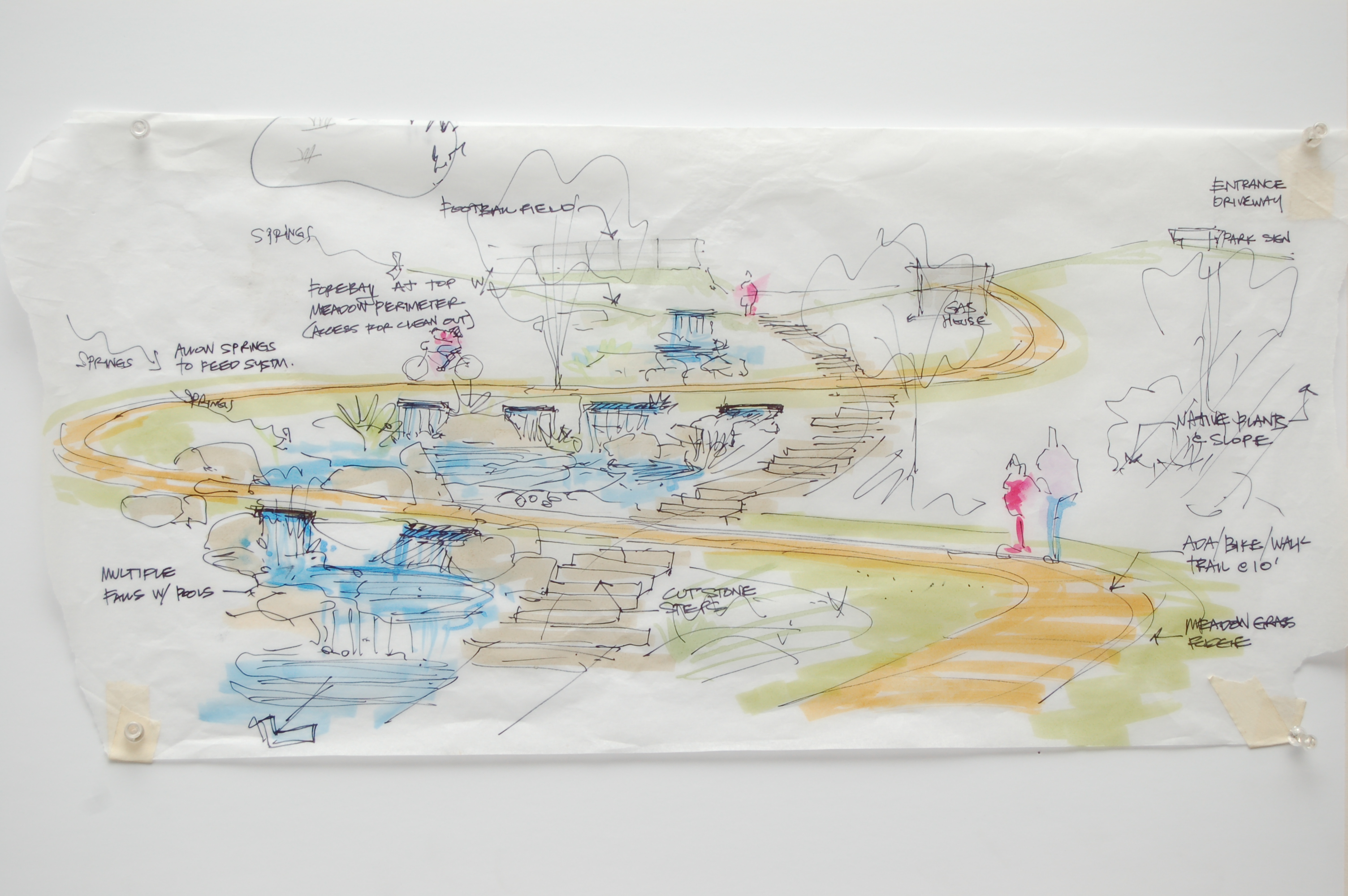
At the base of the existing stonework, the main path will lead visitors up the hillside and through a series of pools and falls designed to convey stormwater and spring water from the park’s upper reaches. This area offers views of the City and the wetland features below and, due to the topography, acts as a pinch point which will help transition from the more intensive uses of the upper park (e.g. football fields and play grounds) to the natural areas of the lower park. Trails will begin here that lead into the wooded hillsides and past the former entrance to a 19th century rail tunnel.
Signage
Educational signage will be placed along the wetland trail, at locations of former industrial structures, and in connection with the Learning Lab. In addition to habitat descriptions, examples of signage will include a contour map depicting the area beginning at the Mission Street Bridge and continuing south through the valley. Arrows will demonstrate drainage; where water is coming off of the hillsides into the conveyance system, and ultimately into the wetland system. Another sign will explain CSO reduction efforts and how runoff toward the South 21st St corridor will be managed within the PWSA and ALCOSAN sewer systems. A third sign will show detailed historical maps of the corridor that tell the story of how Quarry Run and South 21st St (formerly Ormsby St) were developed in the 19th century. The maps show Winter Brothers Brewing Company, Keeling’s Coal Mine Railroad with its incline plane, and the Sankey Brothers Brick Yards. Sculptures and relics along the trail will help visitors visualize the park’s industrial past.
Hydrological and Hydraulic Functions
Currently, the park area contains no stormwater management control facilities and stormwater flows directly into the PWSA combined sewer system, allowing for no rate, volume or water quality mitigation. The network of constructed wetlands have been sized to store 27,000 ft3 of runoff from improved park drainage, managing stormwater near the surface before it reaches the combined sewers; reducing annual wet weather discharges from the park to the combined sewers by 86%, and releasing slowly over several days to provide volume for the next rain event. While fully separating combined sewers is extremely costly, strategically separating stormwater at key locations can be done affordably, with minimal inconvenience, and can introduce a wide range of green amenities and habitat.
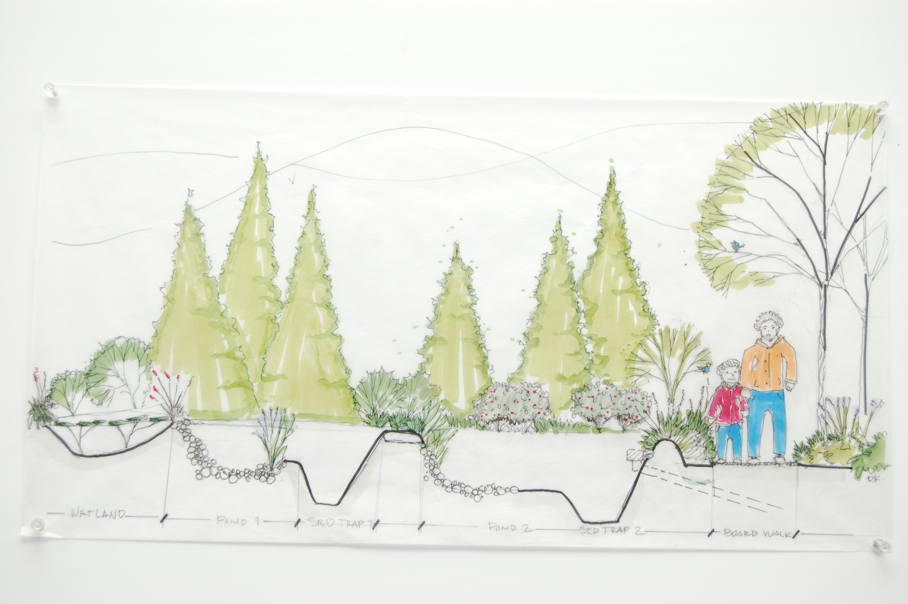
Improved drainage from the hillsides and the field area (upper park) will be directed toward a stone-lined channel that replicates a mountain stream with an accessible pathway connecting the upper and lower areas. Discharge from the stream will feed the first of the wetland systems, each consisting of a forebay for sediment capture followed by varied moisture regimes and microclimates to support a range of obligate and facultative wetland plants. Each wetland is equipped with a discharge structure that permits high flows once the wetland has reached capacity and regulates low flow between rain events. The network of constructed wetlands is sized to store in excess of the one-inch runoff volume and to improve water quality to conditions acceptable for human contact.
At the foot of the park, a reservoir will release the treated water at a controlled rate, conveyed to the downstream ROW green infrastructure (GI) proposed for South 21st St. This reliable base flow will improve the resiliency of the ROW systems, increase the range and health of plants there, and demonstrate the restored functionality that is possible when daylighting urban streams. When volumes exceed the capacity of the downstream systems, overflows can be directed back to the combined sewer.
A recent innovation in stormwater management involves the use of an intelligent control system that uses weather forecasts to release water stored in a reservoir in advance of the predicted rainfall, thus increasing available storage volume for the next storm. This automated control system, along with the buffers provided by the wetland capture/release network, will restrict the rate of discharge to within a range that can be safely managed by the downstream ROW systems, minimizing or eliminating stormwater contributions to the combined sewers.
With these measures in place, additional separation of downspouts and street-level runoff can extend to areas further uphill, providing a place for users and neighborhoods to discharge their new GI. As more of the watershed is captured and diverted from the combined sewer, the wetland detention system within the park will be fine-tuned to accommodate the additional contributions, with adjustments to peak storage depths, low-flow discharge rates, and altering the settings of the intelligent controls. In this way, the Southside Park detention system will continue to grow and function for decades to come.
Ecological Functions and Benefits
From lower Southside Park to Josephine Street, ecological function and benefit will be improved by the addition of natural systems to the park and street-scape. At the upstream portions of the site, developed green infrastructure will have a number of forested and herbaceous wetland communities to slow and uptake water. These ecological communities will anchor new soil, slow the rate of flow of stormwater, shade pools and riffles, filter runoff, and provide habitat to new wildlife species in the park. In addition, increased air filtration, shade, cooling, and calming will be experienced by the park user.
Our goals are to recreate a functional and diverse ecological community that can sustain itself into the future. In order to do that, all layers of the forest and wetlands will need to be considered and installed. Organisms colonizing these wet niches will attract and sustain foraging birds, turtles, frogs and salamanders which, in turn, will attract larger birds to the wooded hillsides. These varied conditions, clustered together in the protection of the ravine, will provide ecological habitats and attract wildlife that would be unique in Pittsburgh.
Possible ecological communities to consider for Southside Park wetlands:
- Red maple black gum forest
- Sugar maple mixed hardwood forest
- Alder dogwood floodplain thicket
- Mixed forb – graminoid wet meadow
- Pickerelweed – arrow arum – arrowhead emergent wetland
- Minimal open water
Team Members
Erin Copeland, Pittsburgh Parks Conservancy
Sam Shamsi, Jacobs Engineering
Sara Thompson, Pashek & Associates
Ian Lipsky, eDesign Dynamics
Mary Bates
Heather Dodson, Michael Baker Corporation
Den Kerlin, RLA, DK Lawrence Design Studio
Bob Gentarz, Mackin Engineering
Lucia M. Aguirre, Lami Grubb Architects
In addition, look at three famous cases where building wraps uk stole the show, transforming architectural monuments into giant advertising canvases. For additional information, please continue reading.